NJ Surf Fishing Report
NJ fishing report for island beach state park and Barnegat bay
New Web Address
The permanent Web Address for this site is www.FishIBSP.com
Island Beach State Park Fishing Report 3-15-13
Island Beach State Park Fishing Report 3-15-13
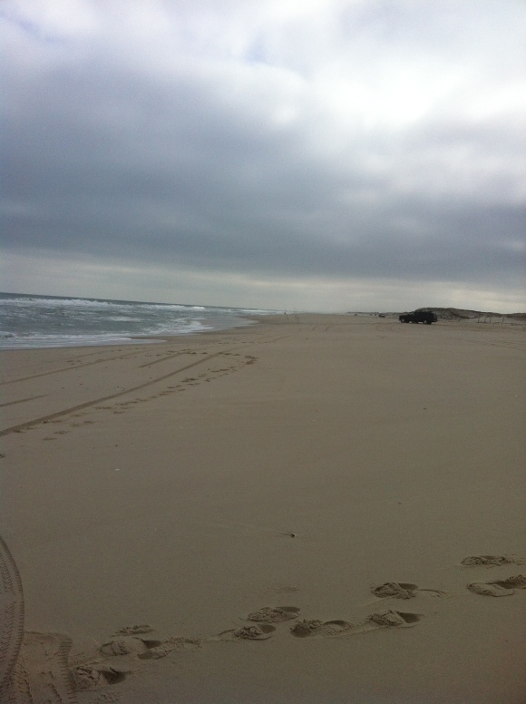
0-2wave height .Breezy west-southwest winds 13 knots whitecapping conditions with moderate choppy seas. Water temp. 42 Degrees.
Tides
03/15 04:36AM LOW
03/15 10:42AM HIGH
03/15 04:40PM LOW
03/15 10:59PM HIGH
Island Beach State Park Fishing Report 3-14-13
0-1 ft wave height. Breezy west-northwest winds 10-12 knots.Whitecapping conditions with moderate choppy seas. Water temperature 42 Degrees. Local angler reported 1 short bass out of the suds on clam. Plenty of short bass are being caught in the back bays and they are biting on blood worms. With no access allowed to the sedge islands from IBSP you will have to be creative in fishing the back waters. Being mid way through March the water temp should climb up slowly. This weekend has a 50% chance of rain for sat but sunday looks clear with highs in the 50’s.
Tides
03/14 03:55AM LOW
03/14 09:57AM HIGH
03/14 04:03PM LOW
03/14 10:16PM HIGH
Island Beach State Park Fishing Report 3-13-13
Island Beach State Park 3-13
Water Temp. 42 degrees
2-3 ft waves from the south. Light northwest winds with a slight chop. Winds will pick up to 12 knots today
4-5 ounces to hold Bottom. Beautiful Sunny day empty beach. No reports of fish as of 10:00am if you have any post them in the comments !!!!
Tides
03/13 03:13AM LOW
03/13 09:14AM HIGH
03/13 03:25PM LOW
03/13 09:34PM HIGH
Island Beach State Park Fishing Report 3-12
Waves from 4-5 Ft
Small short period wind waves from the south. Windy conditions with choppy seas. Winds from the south-southeast 20 kts. Rainy day empty beach
Tides
03/12 02:28AM -0.65ft. LOW
03/12 08:30AM 5.34ft. HIGH
03/12 02:46PM -0.73ft. LOW
03/12 08:52PM 5.37ft. HIGH
IBSP Fishing Report 3-10-13
Windy rough and cold out on IBSP. 8 oz to hold bottom. Early morning the beach was empty. Around 2:00 the wind settled down a bit and about 2 dozen anglers made there way down the beach. There wasn’t much on the way of fish. But everyone seemed just happy to get their lines wet. No fish but great day to be back on the Island!!!!
Info on deciding to raise your house after Hurricane Sandy
Recent public forums have helped answer questions about repairing and rebuilding after Superstorm Sandy.
The question-and-answer sessions typically feature local residents, Federal Emergency Management Agency (FEMA) representatives and representatives of the local insurance and real estate industries.
Even the panelists usually acknowledged a fair amount of uncertainty about the full ramifications of the unprecedented level of damage for the region and the process for rebuilding and recovering costs.
Here’s our best shot at summarizing the considerations for property owners as they rebuild after the Oct. 29 storm. But because of the considerable amount of confusion surrounding the whole process, feel free to share information, questions and observations in the comments section of this story.
Find the elevation of your home.
Find the elevation required for your home under the new FEMA flood map. Search for your Advisory Base Flood Elevation by address.
See how your advisory elevation compares to Hurricane Sandy flood levels. Make sure the flood elevation on your certificate uses the same NAVD 1988 scale as the ABFE maps (or see how the scales compare).
What if your home remains below the required elevation? One thing appears certain: Your flood insurance premium will increase (because federal taxpayers will no longer subsidize the flood insurance program).
The following are projected National Flood Insurance Program (NFIP) annual flood insurance premiums for V Zone properties with $250,000 residential building coverage:
Lowest Floor Elevation
No Contents Contents
3 Feet Above $2,403 $2,923
2 Feet Above $3,278 $4,048
1 Feet Above $4,728 $5,918
At BFE $6,803 $8,603
1 Foot Below $9,003 $11,583
2 Feet Below $12,074 $15,764
3 Feet Below $15,524 $20,474
4 Feet Below $17,334 $23,304
6 Feet Below $23,449 $32,019
The following are projected annual flood insurance premiums for A Zone properties with $250,000 residential building coverage:
Lowest Floor Elevation
3 Feet Above $376 $561
2 Feet Above $448 $633
1 Feet Above $660 $845
At BFE $1,359 $1,724
1 Foot Below $4,527 $5,255
2 Feet Below $5,924 $8,308
3 Feet Below $7,204 $10,554
4 Feet Below $9,551 $14,370
6 Feet Below $18,830 $28,535
Consider the resale value of homes that remain below base flood elevation. Buyers would potentially assume dramatically higher flood insurance premiums or the cost of elevating homes.
What resources are available to elevate homes? Flood insurance policy holders should be able to take advantage of “Increased Cost of Compliance” (ICC) funding that can pay up to $30,000 to elevate homes. In a much longer process, property owners also can apply for hazard mitigation grants. Interested owners must contact the city’s Emergency Management Department, which will submit a letter to the county by Feb. 8 (the city currently has a list of about 100 owners). The county will apply to the state, which will apply to the federal government. Also: Low-interest loans (1.68 percent) of up to $200,000 (for homeowners) and $2 million (for businesses) are available through the Small Business Administration.
Will the Advisory Base Flood Elevation maps change? According to Gov. Chris Christie’s executive order on Thursday (Jan. 24), the advisory maps are adopted and nobody is “grandfathered” for the purposes of flood insurance or building codes. The final maps are expected to be complete by late summer and will likely include lower elevations and smaller “V Zones” as mitigating factors are taken into consideration. An appeals process will also be in effect when the final maps are released. Challenges from shore municipalities and from lawsuits are likely in the works.

